An open letter to East Bay Cyclists on the occasion of the opening of the Richmond-San Rafael Bridge Bike Path
|
East Bay cyclists – Welcome! The bike lane on the Richmond-San Rafael bridge opens up lots of wonderful connections and riding for cyclists all over the San Francisco Bay Area. If you’re starting to explore riding in Marin County via the Richmond Bridge, here are a few things that might be helpful. First off, here’s how to get from the Marin side of the Richmond Bridge to the Golden Gate Bridge (12 miles) and beyond, into San Francisco and down to the Ferry Building or BART to catch transit back to the East Bay. There are a couple of variations on this route but it’s pretty standard and it has only two moderate hills. NOTE – to get to the start of this route you need to ride on the shoulder of 580 for about 400 yards – it’s permitted and it’s no big deal but it doesn’t work with the routebuilder. Richmond Bridge to Golden Gate and San Francisco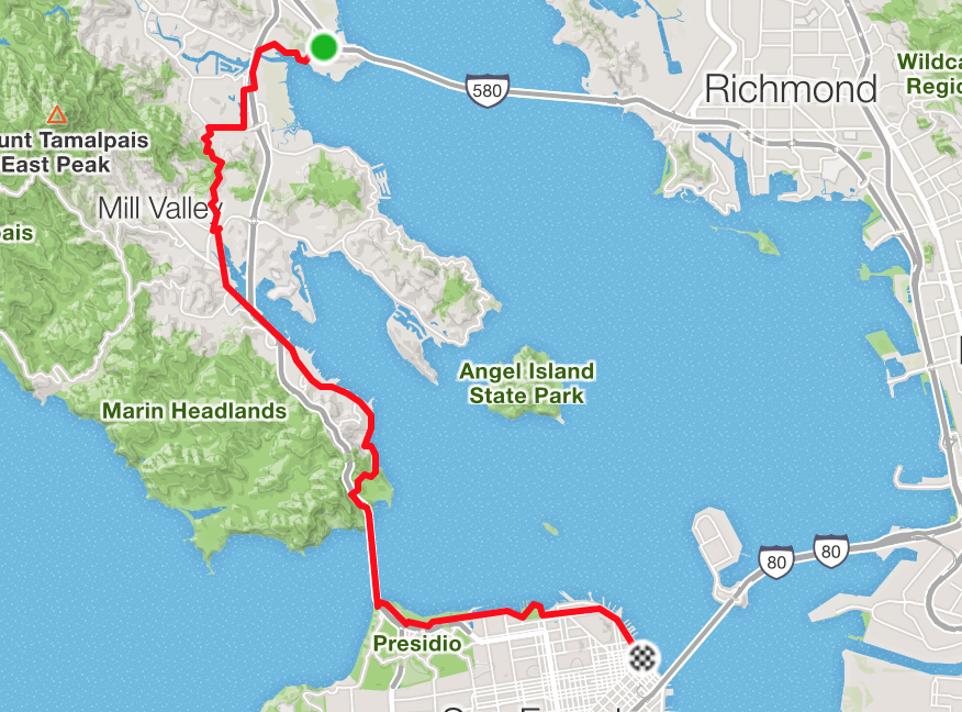 If you’re looking for a good local loop before heading back across the Richmond Bridge, there are two good options – China Camp (San Pedro Road) to the north, and Paradise Drive/Tiburon to the south. Each is about 20 miles and features flat to rolling terrain with no major climbs. China Camp Loop from Richmond Bridge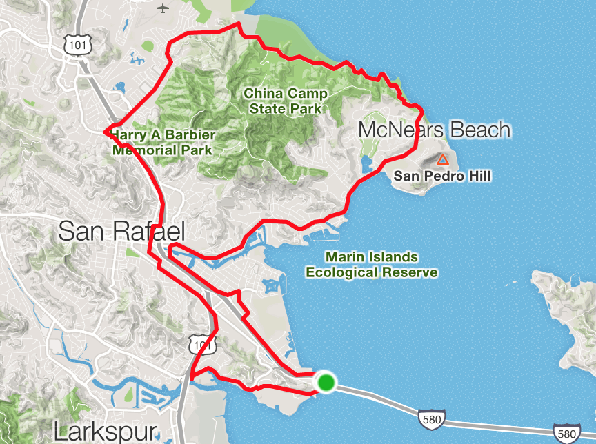 Paradise Loop from Richmond Bridge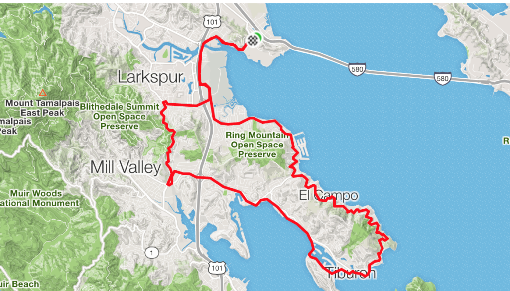 If you’ve got more time and you want to tackle Mt. Tamalpais, there are several routes. Most of them involve going through Fairfax or Mill Valley and the best routes to the base of the climb aren’t straightforward. This loop climbs Tam from Mill Valley then descends through Fairfax. It can be reversed to approach the mountain from the Fairfax side. The first few minutes of climbing out of Mill Valley are a bit complicated on small residential streets but it’s a common alternative to climbing Highway 1, which can be difficult with traffic. Mount Tamalpais from the Richmond Bridge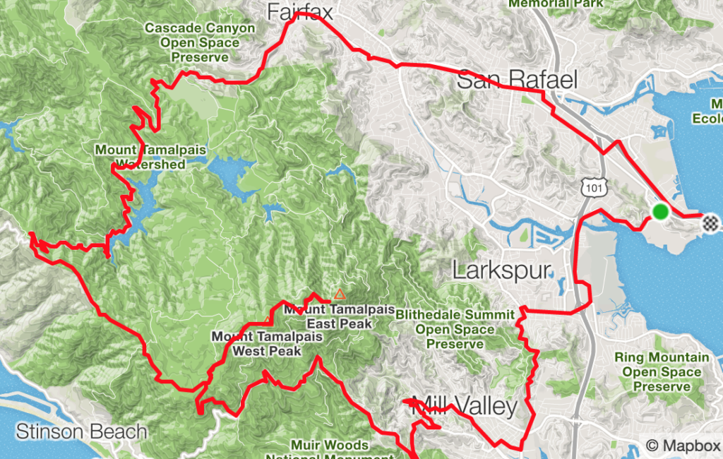 I hope these routes are helpful and get you off to a good start for riding in Marin County. A good resource for even longer rides in Marin is the Strava Heatmap, which shows where cyclists ride most often, and the excellent Marin Bicycle Map available from the Marin County Bicycle Coalition. They do good work. |