Hawk Hill, across the Golden Gate Bridge from San Francisco, is one of the most beautiful, most popular, and most important recreational cycling routes in the world. Over 400,000 visits have been recorded by more than 40,000 cyclists on Strava. This is now illegal
Recent changes implemented by the Golden Gate National Recreation Area (“GGNRA”) have taken away space for people who bike in favor of a cars-first redesign that prioritized motor vehicle parking over off-peak, low-impact users like cyclists. Riders are now confined to a narrow, rock-strewn gauntlet between a hard curb and oncoming traffic. Parts of this corridor are “protected” by hazardous bollards that make the lane even narrower than what GGNRA promised.
Hawk Hill isn’t yet unrideable, it’s just somewhat worse. What was once a great and iconic cycling treasure is now crowded, confusing and confined.
TL;DR – What Can I Do? Write to Darren Brown (darren_brown@partner.nps.gov) at the GGNRA with a copy to their Public Affairs office ( goga_public_affairs@nps.gov ) and ask for space for people who bike on Hawk Hill. Write to the Marin County Bike Coalition and ask MCBC to hold GGNRA accountable for the promises it made to cyclists. For a sample letter and detailed instructions, see this Google Doc.
What’s wrong with the new configuration?
1. The new cars-first configuration prioritizes peak-time parking over off-peak, low impact visitors like recreational cyclists.
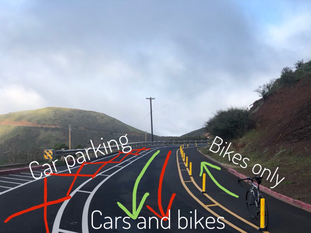
2. The bike lane is too narrow. It’s only 7′ wide and it’s between a hard curb and a row of bollards that would cause a bike to crash if struck. Because of Hawk Hill’s steep grade cyclists ride it at a range of speeds. There’s not enough room to overtake slower riders in this narrow lane. Because of this, riders often ignore the lane and cross into the oncoming traffic lanes.
3. The new design confines cyclists to the portion of the road with the most debris. Sharp stones and rocks accumulate in the bike lane in the rainy season and cyclists now have no legal way to avoid them. The bollards prevent GGNRA from sweeping the bike lane.
4. The new design can’t handle motorist traffic at peak times, even after the appropriation of space from people who bike The travel lane isn’t wide enough to navigate around the frequent entry and exit from parallel parking spaces. Motor vehicle traffic still grinds to a halt on sunny weekends.
5. The lane markings and wayfinding are inadequate. Motorists and cyclists alike have trouble determining which lanes are for travel in which direction and which are for parking or for bikes.
6. The new design provides no legal space for pedestrians. Pedestrians must either walk in the bike lane or step over the crash barrier on the south and walk off-path, parallel to the road.
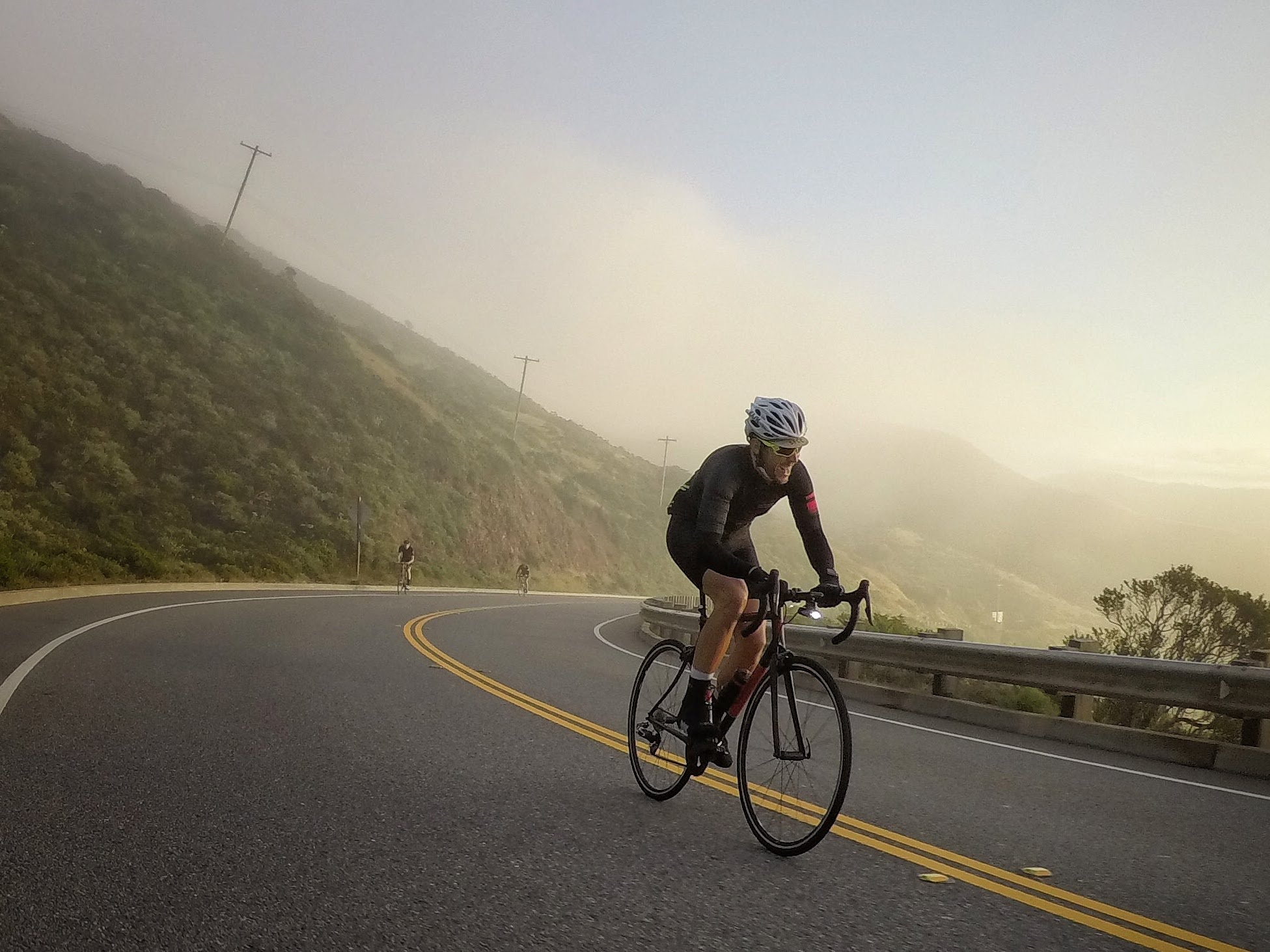
What Happened? For years recreational cyclists enjoyed Hawk Hill’s iconic climb up Conzelman Road from the Golden Gate Bridge without much trouble. Cyclists had access to a 4.25′, unprotected but striped bike lane and full use of the uphill westbound lane which was shared with motor vehicles. (video) The road became clogged and congested with motor vehicles at peak motorist and tourist times like sunny weekends and sunsets, but frequent cyclists rarely visited at those peak times. They weren’t peak for us.
The original configuration worked well for cyclists
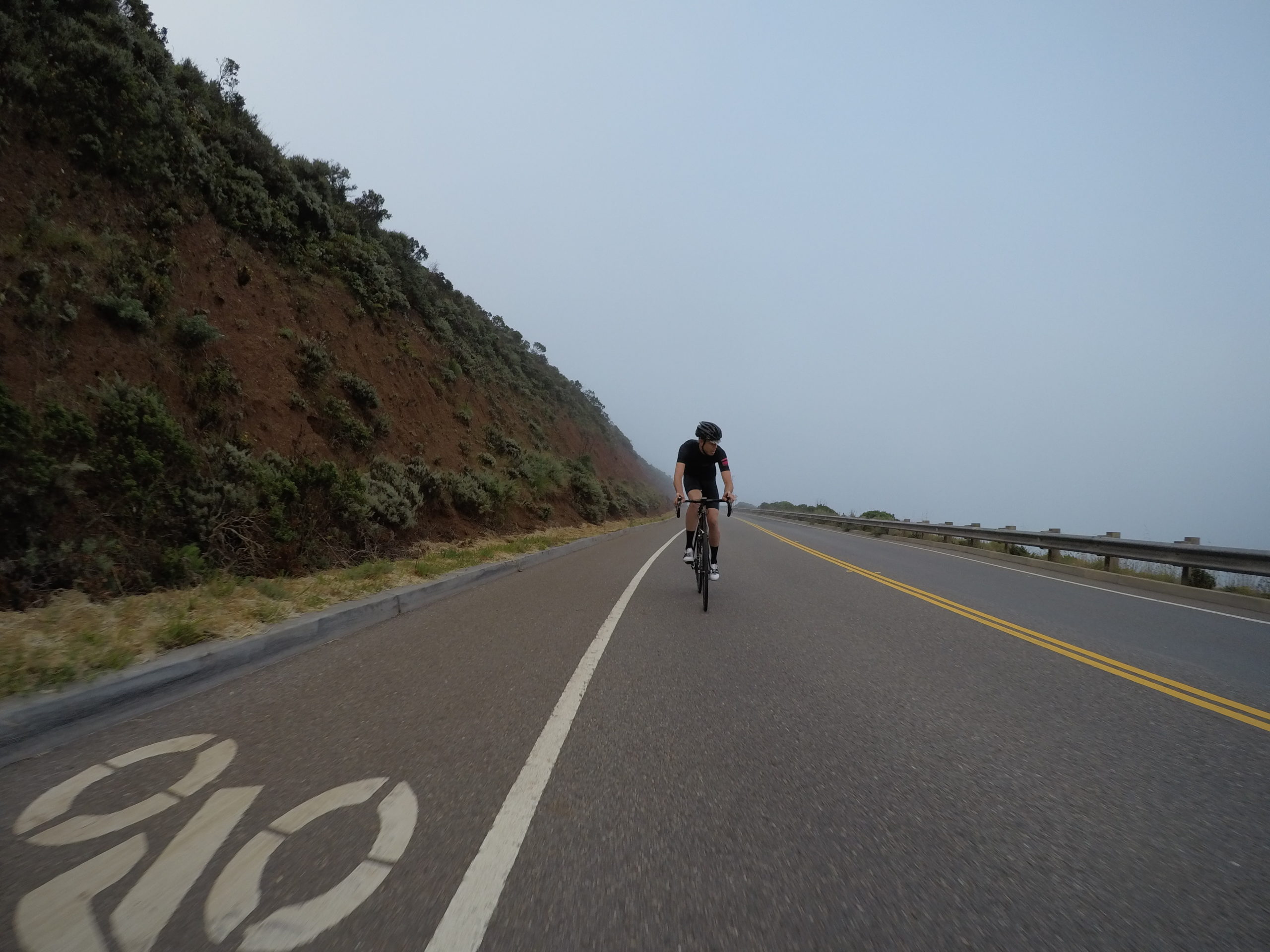
At motorists’ peak times, drivers would sometimes park illegally in the bike lane. GGNRA responded by placing high bollards between the bike lane and the roadway, restricting cyclists from their legal right to ride in the roadway and penalizing off-peak, low-impact cyclists for the bad behavior peak motorists. Even worse, the bollards were often knocked over into the bike lane, further narrowing the marginal, insufficient space for people who bike.
In Summer, 2018 GGNRA experimented with a pilot program to close uphill motor traffic on Conzelman but to allow cyclists access, restricted to the narrow, unswept, and now bollarded bike lane. In April 2019 GGNRA implemented this traffic flow on weekends, and shortly thereafter they decided to make it permanent. The Marin County Bicycle Coalition (“MCBC”) and the San Francisco Bicycle Coalition were consulted only after the general outline of this cars-first, parking-expansion plan was settled and were able to offer input only on marginal details.
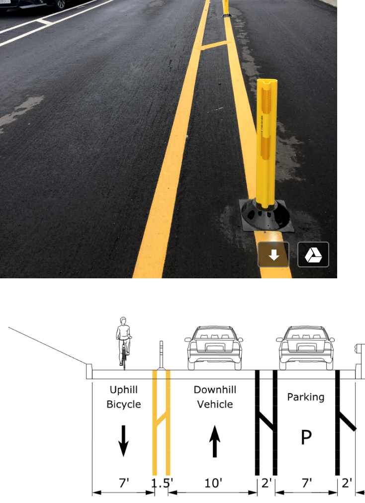
GGNRA agreed on a plan that provided a seven foot dedicated bicycle lane protected from oncoming traffic by an eighteen-inch buffer zone, with flexible bollards in the middle of the buffer zone. This design is not an improvement for off-peak recreational cyclists. It might be somewhat better for less-experienced cyclists who are unlucky enough to visit during peak motor vehicle times, but only because GGNRA was unable to keep the original bike lane clear of illegally parked cars. Despite this configuration being a sacrifice of space and safety for cyclists, the MCBC agreed to the plan as the best they could get a the last minute. What we got versus what we were promised
Once construction began, GGNRA immediately began taking space away from people who bike, further narrowing the already marginal, rock-strewn corridor into which it had forced cyclists. The October repaving included bike lane flags only 4.25′ from the curb. The contractors laid out cones improperly, creating a 4′ bike lane that cyclists had to move manually. Then, when the permanent striping was done, GGNRA placed the bollards at the right edge of the buffer zone (the bases are actually in the bike lane) instead of in the center of the buffer zone, effectively confiscating 10% (9 inches of the 84 inches) of the space allocated for people who bike.
GGNRA has justified this appropriation as a “slight modification” and accused cyclists of “misunderstanding” the purpose of the buffer zone. They say they need the extra space for buses and large vehicles, which may be true but was true when the design was agreed and approved. If there isn’t enough room for buses and large vehicles, then there isn’t enough room for the new parking. Additional space must be taken from parking, not from the already inadequate and marginal bike lane.
Our bicycle coalitions largely dropped the ball on this vital cycling route. It falls between the cracks somewhat because it’s used mainly by San Francisco cyclists but it’s technically in Marin County. I’m very sad that the Marin County Bicycle Coalition accepted GGNRA’s excuses and acquiesced to the appropriation of 10% of the space for people who bike on Conzelman. If you agree that MCBC should hold GGNRA accountable at least to its agreed-upon design, write to MCBC and ask them to rejoin the fight. SFBC has chosen to follow MCBC’s lead on this issue. If you want to urge SFBC to act, please write to them too.
Fundamentally I suspect that even with GGNRA’s confiscation of space from cyclists, the new design is flawed. There simply isn’t enough room on Hawk Hill for the parking that GGNRA added, and they will want more and more space from people who bike. The bollards are a terrible solution for bikes – a motorist who strikes a bollard may feel a thump. A cyclist who strikes a bollard will crash. The new lane doesn’t have any real separation from directly oncoming traffic, only plastic posts that wouldn’t stop a car but would make a bike crash. Lane markings are confusing and ambiguous at best.
What do we want? In the short run, the GGNRA should honor its commitment to people who bike and place the bollards properly in the center of the buffer zone. We want MCBC and SFBC to advocate for space for people who bike on Hawk Hill. In the long run I believe that GGNRA should prioritize off-peak, low-impact visitors and remove, not add, parking from Hawk Hill. There are a number of good ways to do this that would improve the visitor experience for everyone.